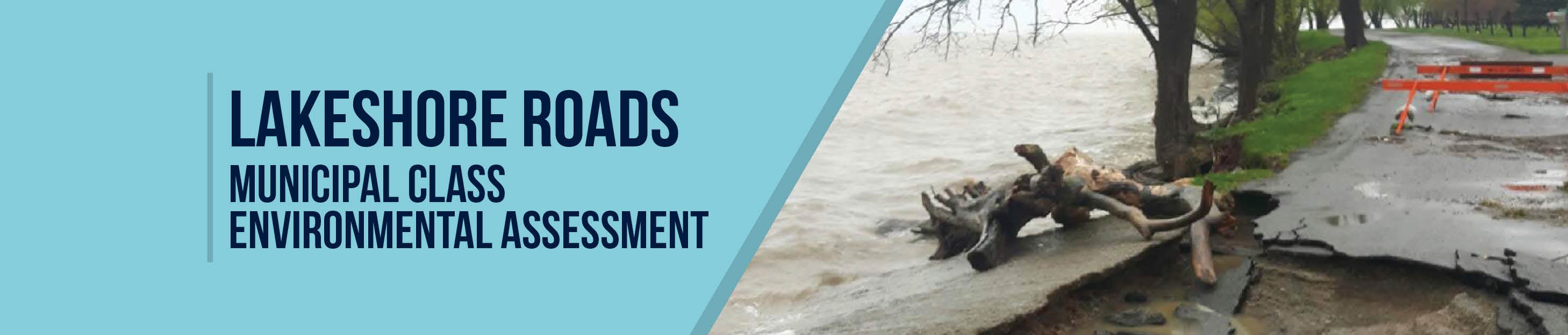
Lakeshore Roads Thirty Rd N to Martin Rd N Improvements - Municipal Class Environmental Assessment Study
Consultation has concluded
Project Overview:
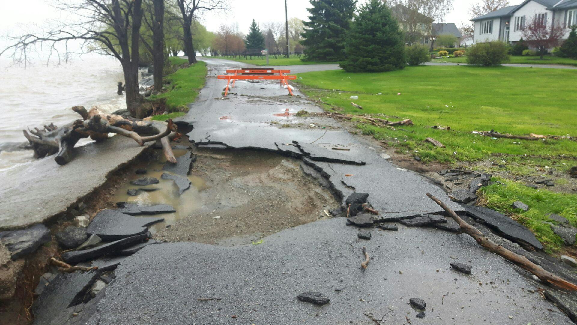
As a result of high-water levels and isolated flooding during the Spring of 2017 and 2019, sections of the Town’s shoreline roads have deteriorated and eroded. This has resulted in significant damage to both the road surface and foundation.
During that time, voluntary emergency evacuations were issued to 50 of the 120 homes located along the shoreline. While emergency repairs to the shoreline and road are ongoing, there are still long-term improvements and climate adaptation actions required.
Following the 2017 and 2019 flooding events, the Town completed several studies to identify the existing condition and potential future solutions for the lakeshore roads and related shoreline improvement needs in order to develop a long-term adaptation plan.
To date, the Town has completed a Shoreline Protection Condition Assessment and, through correspondence with the Niagara Peninsula Conservation Authority, has identified hazards along the Lake Ontario shoreline. The Town is currently finalizing the Flooding and Erosion Emergency Response Plan as well, which will ensure operational plans and communication to impacted residents is formalized. The Town has also recently completed a Corporate Climate Adaptation Plan that identified the Lakeshore Road shoreline as a priority. It is intended that the design will incorporate adaptation measures for the increased lake levels and impacts of waves and/or freeze/thaw cycles.
The next step of the process is to complete a Schedule ‘C’ Municipal Class Environmental Assessment (MCEA) to identify and evaluate alternative solutions. This MCEA will also determine a recommended plan for the shoreline roads and enhance the resilience for access on lakeshore roads and their associated shoreline improvements. In 2021, the Town retained WSP to undertake this MCEA. The study area for this MCEA can be found below:

The completion of the MCEA for the Lakeshore Roads and Shoreline Improvements, and the design and construction of the identified recommended plan are aligned with the Town’s priorities as determined by the Town’s Corporate Climate Adaptation Plan, Transportation Master Plan, and Active Transportation Master Strategy.
As part of the EA process, WSP will complete field investigations to document existing conditions including:
- Natural environment inventorying of animal/bird/fish surveys
- Agriculture investigations
- Socio-economic investigations
- Site contamination overview
- Archeological and built heritage investigations
Mitigation Plan:
To address the identified flood hazards, the Town is proposing the development of a mitigation plan that will include the two (2) Project components described below:
1. The Environmental Assessment (EA) will identify and analyze possible flood mitigation measures, discuss best practices, and recommend measures to reduce flood risks for the lakeshore/shoreline roads. It will also review land acquisition requirements. Ultimately, the EA will identify shoreline improvements that are recommended which may include road relocations. This project will also include the development of a provisional enhanced conceptual design for the preferred solutions. This will include the collection of all project related information into a report and drawings. This stage will form the basis for continuing into the detailed design stage. The project will examine connectivity to the areas of the shoreline where improvements are needed, which act as major points of access for blue and green spaces. This will result in increased active transportation benefits for the residents within the EA study area, and also by those outside of these neighbourhoods.
The MCEA will be comprised of the following four phases:
- EA Phase 1: Problem or Opportunity
- EA Phase 2: Alternative Solutions
- EA Phase 3: Alternative Design Concepts for Preferred Solution
- EA Phase 4: Environmental Study Report (current phase)

Project Update: At this time, the Project Team has finalized the preferred alternative and prepared the final draft of the Environmental Assessment Report (ESR). The assessment takes into consideration a number of items including social, environmental, agricultural and financial impacts. In accordance with the MCEA process, the ESR is being made available for a 30-day comment period starting on March 2, 2023 and ending on April 1, 2023. A Notice of Completion has been mailed to residents in the study area, emailed to the project email list, and published on speakuplincoln.ca, in local newspapers, and on social media. The complete ESR and Appendices can be found in the "Documents" section on the right. The ESR is available for review at Town Hall (4800 South Service Rd., Beamsville, or the Fleming Centre (5020 Serena Dr., Beamsville). If you wish to review ESR and require an alternate format, please contact the Project Team.
2. The development of community education and awareness materials. These materials will inform residents about flood prone areas and ways residents can minimize risk on their property.
These materials will, at a minimum; provide information on:
- Emergency contacts
- Types of flooding and flooding prevention (key areas along shoreline)
- What to do before a flood (flood proofing, sump pump inspections, preparing a go-kit, insurance considerations)
- What to do during a flood (including measures for both evacuation and sheltering in-place)
- What to do after a flood (clean-up procedures, safety precautions, food safety, disposal of materials, replacement of documents)
- Health considerations
- Repairing your home
- Grant and subsidy programs
- Flooding checklist
The Environmental Assessment and public education materials will benefit the geographic area and the surrounding community in many ways. This two-pronged approach ensures that mitigation planning considers all vulnerable areas of the shoreline in some capacity.
Public Engagement:
Public engagement is an important component of the MCEA, and the Town will work with, consult, and engage with interested stakeholders, including the public, landowners, and regulatory agencies, throughout the course of the study.
You are also encouraged to visit this page regularly to view project information including study notices, background information, and study updates. You can also submit comments and questions to the Project Team using the methods outlined on this website.
PUBLIC INFORMATION CENTRE #1
The first of two Public Information Centres (PICs) was held virtually via Zoom on October 5, 2021 from 6:00-8:00 p.m. The goal of this PIC was to provide an opportunity for the public to review the environmental existing conditions and alternative design concepts, provide comments, and discuss concerns and issues with the Project Team. The PIC #1 presentation, summary report and recording can be found on the right side of the page and has also been sent to the project mailing list. The PIC Survey related to PIC #1, was open until October 20, 2021.
PUBLIC INFORMATION CENTRE #2
The second Public Information Centre (PIC), was held virtually via Zoom on December 7, 2021 from 6:00-8:00 p.m. The goal of this PIC was to provide an opportunity for the public to review the evaluation of the alternative design concepts and the Preliminary Preferred Alternatives for each of the seven sections, as well as to provide feedback to the Project Team. The PIC #2 presentation, summary report, and recording can be found on the right side of the page. The PIC Survey related to PIC #2, was open until January 14, 2022.
How to participate:
- E-mail LakeshoreEAs@lincoln.ca or call 905-563-2799 ext. 281 to have your name added to the project mailing list; provide any comments, questions, or concerns about the study; or to request a meeting with the Project Team to discuss property specific questions, utilities, or comments
Further Details:
This study will follow the Municipal Class Environmental Assessment (MCEA) for a Schedule ‘C’ project following the requirements outlined in the Municipal Engineers Association MCEA manual (October 2000, as amended in 2007, 2011 and 2015). This is an approved process under the Ontario Environmental Assessment Act. This MCEA will be completed with a focus on the analysis of the social, environmental, and economic impacts of each alternative solution in order to determine a preferred solution. Under the Freedom of Information and Protection of Privacy Act (FOIPPA) and the Access to Information Act, comments and information regarding this project, with the exception of personal information, will become part of the public record.
The Town of Lincoln values engaging with residents and welcomes receiving feedback on service delivery and projects. The health and safety of our employees and community is paramount. In accordance with the Town’s Violence and Harassment in the Workplace Policy, Town staff will not tolerate any form of violence and harassment in our facilities or through online platforms. Where threatening behaviour is observed over the telephone, in-person or online, Town staff will terminate the communications after giving due warning of the intention to do so, as required. Thank you for your consideration and remaining respectful as we work together.
Signup Banner

PIC Video Recordings
-
A live Public Information Centre (PIC) was held on December 7, 2021 to provide an opportunity for the public to review the evaluation of the alternative design concepts and the Preliminary Preferred Alternatives for each of the seven sections, as well as to provide feedback to the Project Team.
Photos
Who's Listening
-

Phone 9055632799 x264 Email LakeshoreEAs@lincoln.ca -

Email LakeshoreEAs@lincoln.ca